Cranham Local History Society Lidar Survey Project.
STOP PRESS NEW SURVEY FLOWN AND DATA AVAILABLE
The local history society has successfully applied for a large grant to carry out a Lidar Survey of the Parish and surrounding area. This will comprise an area of about 100 sq km, running from Leckhampton Hill Fort to Haresfield Beacon and over to Miserden.
The funding has come from the Cotswold Conservation Board, Local History Societies and Trusts and Crickley Hill Sites Warden.
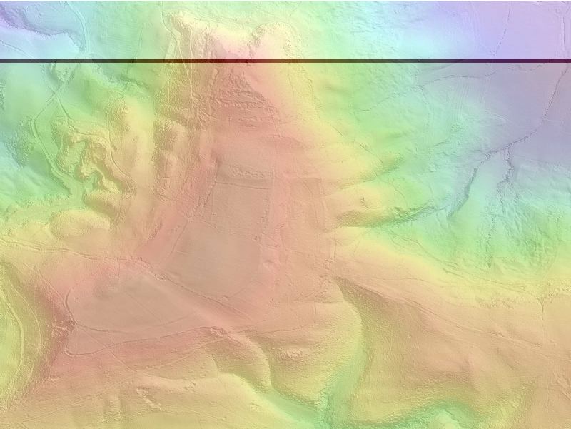
Lidar is a new aerial survey method that can detect the remains of structures hidden underneath trees. The Lidar instrument is mounted in an aircraft which flies over the area to be surveyed. A scanning laser is reflected off the ground to map the area underneath the flight path. The first reflection maps the tree tops and the last reflection maps the ground surface under the trees. We are planning to make a measurement is each square meter of the parish with a vertical resolution of 150mm.
We also plan to collect vertical colour photography of the entire area at the same time.
This data will be available as an interactive atlas and ascii x,y,z gridded data.
This is the first survey of this type carried out by a local history society.The survey results will be available to anyone who is interested in it for non comercial use.
The survey has been flown and an interactive atlas is available of 100 sq km surrounding the parish
If you want a copy of the atlas email info@cranhamsurvey.org.uk